
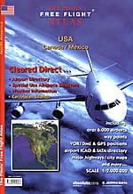
Printed atlas
Atlas USA, Canada & Mexico
The USA, southern Canada, Mexico and the Caribbean — more than 5,500 airports on a 1:2,000,000 topographical base.
Secure checkout handled by PayPal — pay by PayPal balance, bank or card. Shipping address collected at checkout.
The Pilots Atlas USA covers the United States, southern Canada, Mexico and the Caribbean across 106 pages at a consistent 1:2,000,000 scale.
The base cartography is the US Road-Atlas, so mountain ranges, lakes, rivers, cities, towns, parks, railways and motorways are all there for ground reference. On top of it sit the aviation layers: over 5,500 U.S. airports colour-coded by runway characteristics and category, VOR/DME navigation aids, reporting points, waypoints, VOLMET frequencies and Special Use Airspace.
Weather radar and satellite photography, political mapping and a full airport directory round it out, alongside a Captain's Corner with conversion tables, crosswind calculations, time zones and international web suffixes.
Prefer digital? The whole region is in the Pilots Atlas app for iPad and iPhone.
Specifications
- Coverage
- USA, southern Canada, Mexico, Caribbean
- Scale
- 1:2,000,000
- Pages
- 106
- Airports
- 5,500+
- Base cartography
- US Road-Atlas 1:2,000,000
- Price
- €29.99 incl. VAT + p&h